
Koyna Dam
Koyna Dam
|
For Prelims: koyna dam,about the Koyna River, Krishna River System |
Why in the news?
The Koyna dam authorities, owing to the poor storage in dams across Satara district, have proposed cuts in water discharge for both irrigation and power generation.
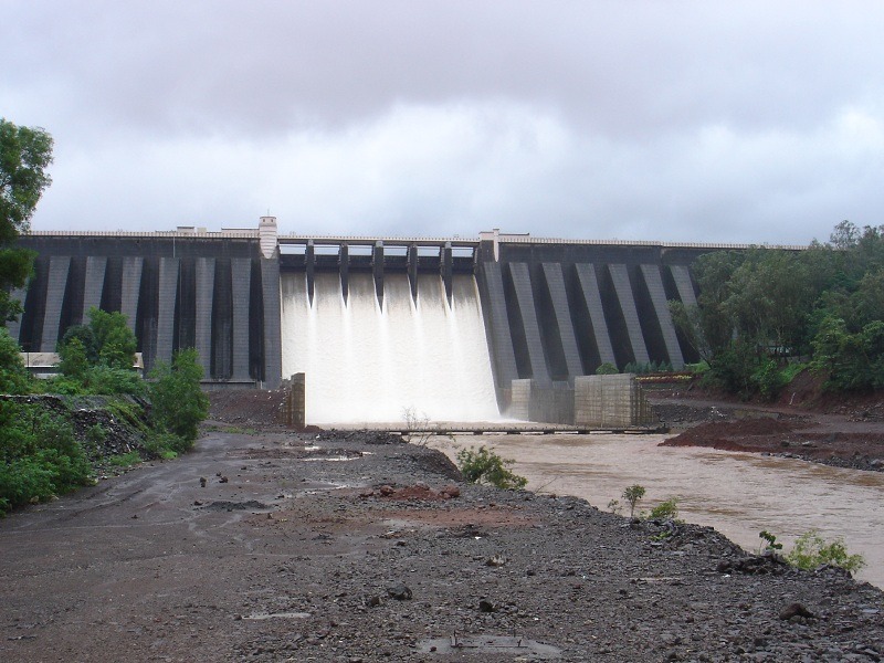
About Koyna dam
- Location: The Koyna Dam is one of the largest dams in Maharashtra, India.
- It is a rubble-concrete dam constructed on Koyna River which rises in Mahabaleshwar, a hill station in Sahyadri ranges.
- It is located in KoynaNagar, Satara district, nestled in the Western Ghats on the state highway between Chiplun and Karad.
- The construction of this dam was completed in 1963 and is among the chief civil engineering projects built after the independence of India.
- The main purpose of the dam is hydroelectricity, with some irrigation in neighbouring areas.
- Koyna Hydroelectric Project is the largest completed hydroelectric power plant in India, with a total installed capacity of 1,920 MW.
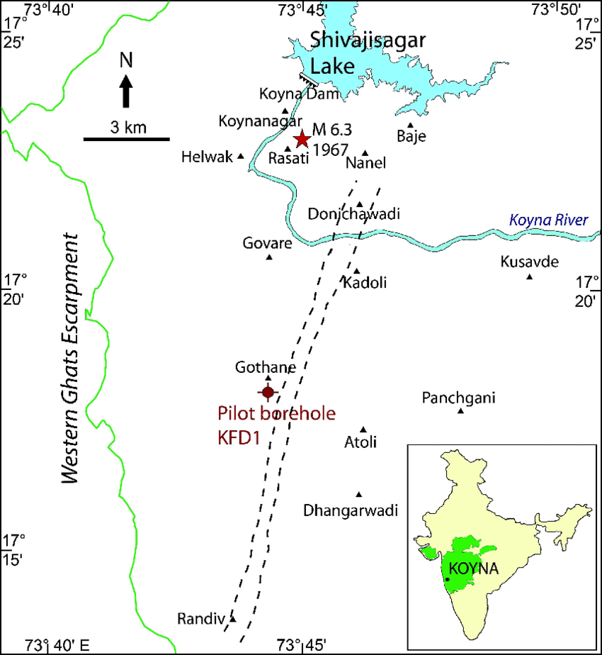
- The catchment area of the Koyna Dam blocks up the Koyna River and creates the Shivsagar Lake, which is roughly 50 km long.
- The dam plays a vital role in flood control during monsoon season.
- The dam plays a vital role in flood control in monsoon season. The catchment area dams the Koyna river and forms the Shivsagar Lake which is approximately 50 km in length.
- It is one of the largest civil engineering projects commissioned after Indian independence. The Koyna hydro-electric project is run by the Maharashtra State Electricity Board.
What are the Key Facts about the Koyna River?
- It is a tributary of the Krishna River which originates in Mahabaleshwar, Satara district, Western Maharashtra.
- The river flows in the north-south direction. Most other rivers flow in the east-west direction. The river is also called the ‘lifeline of Maharashtra’.
- Four tributaries of Koyna river are:
- Kera, Wang, Morna and Mahind.
- It covers an area of 2,036 km2 in the Deccan terrain of the district of Satara in the state of Maharashtra.
○With an elevation range of 550 – 1,460 m above mean sea level it typically represents a physiographic setup characterized by the Deccan plateau in the Western Ghats region.
- The river merges with the Krishna River at Karad in the Satara district of Maharashtra.
- Due to its electricity-generating potential through the Koyna Hydroelectric Project, Koyna River is known as the LifeLine of Maharashtra.
Krishna River System
- It is the second-largest east-flowing river of the Peninsula.
- It rises at Mahabaleshwar at an altitude of I336 m near the Jor village in the extreme north of district Satara, Maharashtra in the west, and meets the Bay of Bengal in Andhra Pradesh, on the east coast.
- Ecologically, this is one of the disastrous rivers in the world, in that it causes heavy soil erosion during the monsoon season.
- It is bounded by the Balaghat range on the north, by the Eastern Ghats on the south and the east, and by the Western Ghats on the west.
- The total length of the river from origin to its outfall into the Bay of Bengal is 1,400 km.
- The major part of the basin is covered with agricultural land accounting to 75.86% of the total area.
- Almatti Dam, Srisailam Dam, Nagarjuna Sagar Dam, and Prakasham Barrage are some of the major dams constructed on the river.
- Because it is fed by seasonal monsoon rains, the river’s flow undergoes great fluctuation during the year, limiting its usefulness for irrigation.
- Satara, Karad, Sangli, Bagalkot. Srisailant, Amaravati, and Vijayawada are some of the important urban and tourist centers on the bank of the river.
Tributaries of Krishna River
Right bank: Venna, Koyna, Panchganga, Dudhganga, Ghataprabha, Malaprabha and Tungabhadra are the major right-bank tributaries.
Left Bank: Bhima, Dindi, Peddavagu, Halia, Musi, Paleru, and Munneru are the major left-bank tributaries.
- The Koyna is a small tributary but is known for Koyna Dam.
- This dam was perhaps the main cause of the devastating earthquake (6.4 on Richter scale) in 1967 that killed 150 people.
Source:Times of India