Geospatial Intelligence
Geospatial Intelligence
Main Examination General Studies Question Paper-3
(Science and Technology)
October 02, 2023
Why in news:
- The summer of 2023 saw the severity of several unprecedented natural disasters across the United States, including record-breaking temperatures, Canadian wildfires, severe flooding and a powerful hurricane, such crises can be mitigated using geospatial intelligence.
- Geospatial intelligence has provided valuable insights to help governments and organizations protect communities from natural disasters.
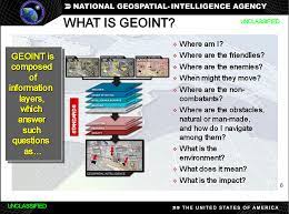
About Geospatial Intelligence:
- Geospatial intelligence, also known as geographic intelligence, is the quality of individuals or communities that make deep connections to their spatial geography, natural resources, and the environment. This intelligence is important for people who want to organize their lives according to their geo-location and ensure their development within the local context.
- Technically, geospatial intelligence is the collection and integration of data from a network of technologies, including satellites, mobile sensors, ground-control stations, and aerial images.
- The data is then used to create real-time maps and simulations to help identify when, where, and to what extent a threat is likely to emerge.
- Government officials, individuals, or both can use this information to make informed decisions.
- The geospatial intelligence industry is projected to grow from a US$61 billion enterprise in 2020 to more than $209 billion in 2030.
- Applications of Geospatial Intelligence:
- • Emergency preparedness and response: Geospatial intelligence helps monitor and respond to disasters such as tropical cyclones by providing information about the location and strength of them.
- • It supports search and rescue efforts, assesses damage and helps allocate resources during emergencies.
- • Environmental monitoring: Geospatial intelligence monitors environmental factors such as temperature, precipitation and polar ice to anticipate disturbances.
- • This data is important to prepare for events such as heatwaves, which can impact human safety and security.
- • Conflict and security: Geospatial intelligence contributes to security by tracking and reporting on events such as the Russian-Ukraine war through satellite imagery.
- Commercial satellite companies now provide important public information, expanding the role of geospatial intelligence in transparency.
- Transportation and logistics: Geospatial intelligence enhances transportation, logistics, and global supply chains using GPS data.
- It provides real-time information on vessel and cargo locations, improving efficiency and reliability.
- Autonomous vehicles and urban planning: High-resolution imagery aids the development of autonomous vehicles and smart urban planning.
- It helps detect features like bicycle lanes and traffic directions on the ground for safer and more efficient communities.
- Use in the development, implementation, and evaluation of digital twins: Digital twins are virtual representations of real systems – buildings or cities, for example – that mimic the characteristics of the system and can be updated in real time to reflect changing conditions in the system.
- Geographical Knowledge: This style helps individuals understand the geography, biodiversity, and natural resources of their place.
- Environmental protection: Geospatial intelligence encourages people to be mindful of their environment. It encourages them to follow measures to protect natural resources, preserve biodiversity, and reduce pollution.
- Social connections: Geospatial intelligence strengthens social connections between people. It builds capacity through working closely with local communities, engaging in community-based projects, and social cooperation.
Importance of Geospatial Intelligence:
- The need for geospatial intelligence is more important than ever as average temperatures are projected to rise between 2 to 9.7 degrees Fahrenheit (1.1 to 5.4 degrees Celsius) by the end of the century.
- The global population is expected to reach 11 billion by 2100, and urban areas are becoming denser and more vulnerable to disasters.
- Geospatial intelligence helps to reconstruct the past, describe the present and predict the future.
- Geospatial intelligence provides valuable information to help keep people and communities safe.
Challenges related to geospatial intelligence:
- There is lack of awareness among users.
- No demand for geospatial services and products.
- Shortage of skilled manpower.
- Non-availability of high-resolution baseline data.
- Lack of ready-to-use solutions specifically developed to solve India's problems.
--------------------------------------
Mains Exam Question
What is geospatial intelligence? Discuss its applications and significance.